
JEBEL QIHWI Facts:
- Also known as Jebel Qa'wah
- Round-trip: - 7hrs (including stops). About 4hrs up 3hrs
down.
- Difficulty: - Easy except care needed on the ledges past
the farm, and the final climb to the summit.
- Liz fear factor: - 3/10 no problems. A bit hairy on the
ledges above the farm.
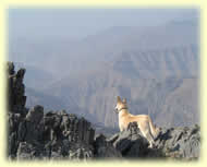
- Chirri dog factor: - Easy peasy. Need plenty of water.
Need my boots if the rock is hot but not too sharp for my pads;
plenty of goats and donkeys to chase. If I wasn't on my lead I'd
love to go off to chase the chickens in the farm. No lamp-posts
or trees, but a few bushes.
- Dangers: - Take care on the ledge, and in the cleft if
you climb up to the summit.
- Pleasures: - Making a brew at the top. Climbing with
a full moon and bivouacking up there. Being above the clouds.
- Wildlife and plants: - Egyptian Vultures, and Bonelli's
Eagles on the ridge. Plenty of rock doves and larks. A few Hume's
Wheatears and Scrub Warblers. Pale Crag Martins near the summit.
- Latitude 25.7439 Longitude 56.2103 Altitude
(feet) 5708
Lat (DMS) 25° 44' 38N Long (DMS) 56° 12'
37E Altitude (meters) 1739 (Datum WGS84)
Introduction
 Jebel
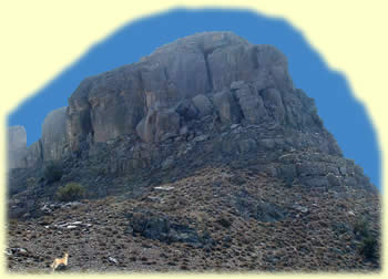
Qihwi is a mountain on the Mussandam Peninsula. Access to
the mountain is from a location on the route from Ras Al Khaimah
to Dibba via Wadi Al Bih. With an altitude of 1794m
according to the map, (or 1739m according to some sources,) and
with a distinctive summit, it is indeed an imposing feature on the
landscape. From a distance, Jebel Qihwi looks pretty difficult,
but because you can start to climb at an altitude of around 1000m,
and the horizontal distance is about 6km, the route up the mountain
is never very steep. Jebel
Qihwi is a mountain on the Mussandam Peninsula. Access to
the mountain is from a location on the route from Ras Al Khaimah
to Dibba via Wadi Al Bih. With an altitude of 1794m
according to the map, (or 1739m according to some sources,) and
with a distinctive summit, it is indeed an imposing feature on the
landscape. From a distance, Jebel Qihwi looks pretty difficult,
but because you can start to climb at an altitude of around 1000m,
and the horizontal distance is about 6km, the route up the mountain
is never very steep.
A large part of the journey is along a ridge with a gradual incline
and amazing views to either side. When I climbed here, there were
a lot of low scattered clouds about, and this made for an unforgettable
experience as the clouds drifted past us across the ridge.
The walk to the base of the summit is long but gentle, however
the summit itself is like a small fort with sheer sides, requiring
a bit of a scramble to get to the very top. The summit area is split
into two parts; the true summit is atop the aforementioned fort,
and the rest is atop something resembling a ship with steep sides,
and again requiring some climbing skills to reach the top.
Just before you leave the ridge to make the final climb to the
summit ramparts, there is a flat area suitable for camping. This
would make a fantastic place to spend a night in the mountains,
and there are signs that people have camped there in the past. This
opens up the possibility of climbing at night, when the moon is
full, and bivouacking, either at the campsite mentioned above, or
at one of the many other suitable spots along the way. This also
means that you could consider climbing Jebel Qihwi at a time of
year when climbing in daytime temperatures would be impossible.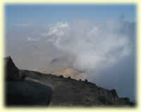
There are usually various ways up a mountain, and Jebel Qihwi is
no exception. The route I will describe here has an interesting
start across a saddle, well used by local people, and then passes
by a substantial farm (inhabited at the time of writing), before
an interesting headland traverse which leads you onto the ridge.
There is plenty to keep your interest along the way even though
the ridge walk can seem endless.
Not everyone will feel confident at tackling the final climb to
the true summit because of the difficulty in negotiating the crack
in the rock, but those that do will enjoy the challenge. If you
forgo this pleasure you can sit and admire the fine views from just
below the final push to the top.
Route description
The fantastic mountain pass that joins Wadi Al Bih to Wadi
Khabb Shamsi and makes it possible to drive the spectacular
route between Ras Al Khaimah and Dibba, can be divided
into three sections. First there is the switch-back road that leads
up from the Omani check-post in Wadi Al Bih, then a short
section at the top which is fairly flat by comparison, and passes
most of the popular camping places, and a couple of farms. Last
there is the series of switch-backs which lead from the top section
into Wadi Khabb Shamsi and on towards Dibba.
The hike up Qihwi starts from the Ras Al Khaimah end of
the middle section at a small 'car park' just south-east off the
road on a bend. (GPS waypoint 25.7810N 56.2125E WGS84). Local farmers
sometimes leave their battered Landcruiser pickups here, and there
is also a water tank here. As this is a popular viewpoint used by
day-trippers on the Wadi Bih tour, there is sadly plenty
of litter scattered around. Some people seem to think that this
is a good place to offload their garbage neatly packed up in plastic
bags no doubt expecting the municipality to come and collect it!
As soon as they are gone, the goats come to investigate and break
open the bag to see what they can find inside thereby scattering
the rubbish far and wide. Sad but true. Please take your rubbish
home with you! Hopefully I'm preaching to the converted, because
my guess is that the culprits are the type that rarely venture from
their vehicles, let alone climb mountains! Just a short distance
from the 'car-park' in the direction of Dibba there is a large flattened
area to the left of the road. This is a convenient place to camp
before or after the hike up Qihwi. Although there is enough space
to camp at the car park it's a bit exposed and the rubbish there
attracts insects and goats.
The hike begins at the car-park and sets off in a south-easterly
direction. A short distance from the start you should pass the ruins
of an old settlement and then traverse the hillside to your left
following a well used path. Your aim is to traverse and gradually
climb up onto the saddle above and to your left.
 The
path forks after some time, and the left fork takes you up onto
the saddle (make sure you keep a good look out for the fork. The
path is well used, but the start is a bit vague). Once on the saddle
continue on in the same general direction still following the most
obvious path which dips and then climbs to skirt the hill to the
left. The direction veers more to the east then more south and crosses
over to the next valley after passing a walled and a fenced enclosure
off to the left. Looking down into this valley you'll see a small
farm perched high on the cliffs below you. The path you are following
is used by the farmer and his donkeys to transport goods to and
fro, so the trail of donkey pooh should keep you on the right path. The
path forks after some time, and the left fork takes you up onto
the saddle (make sure you keep a good look out for the fork. The
path is well used, but the start is a bit vague). Once on the saddle
continue on in the same general direction still following the most
obvious path which dips and then climbs to skirt the hill to the
left. The direction veers more to the east then more south and crosses
over to the next valley after passing a walled and a fenced enclosure
off to the left. Looking down into this valley you'll see a small
farm perched high on the cliffs below you. The path you are following
is used by the farmer and his donkeys to transport goods to and
fro, so the trail of donkey pooh should keep you on the right path.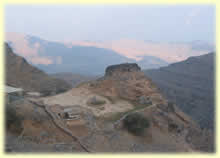
Instead of descending to the farm you should leave the main trail
and contour to the right above the farm. There are many goat tracks
along here so just choose the most convenient. Just past the farm
the hillside heads right into a gully and the rock formation at
this point forms convenient ledges to walk along and into the gully.
If you've chosen the correct ledge you'll arrive at a point where
the gully can easily be crossed. If not, you'll have to scramble
up or down. Once there you cross the gully and pick up the obvious
path on the other side. Continue contouring on this path taking
any options that climb up to the right to take you up onto a col.
Here you should be on the main ridge which leads SSE to Jebel Qihwi.
There are various options here. If you adhere strictly to the ridge
you will have to ascend and descend a rocky hill, so the best options
are to traverse round this hill either to the right or left. There
are good paths both ways, and you can go one way and return the
other if you wish. The path to the right tends to stay level for
quite a distance and leaves you with a steeper climb back onto the
ridge but gives spectacular views back towards the car park where
you started. Eventually both paths meet up on the ridge and from
there the way is fairly obvious.
Keeping to the ridge there are a few flat places suitable for camping
but the best is at the top of the spur which leads you up to the
ramparts of the Jebel itself. The part of the mountain you should
head for is to the right hand end where there is a narrow cleft
in the vertical cliffs. You can stop at the foot of the cliffs and
admire the views or if you fancy a bit of a scramble, you can ascend
the narrow cleft and climb to the summit. This is a fantastic viewpoint
and from here you can see just how deep the wadis in this area are
and how relatively flat the mountain tops are.
Supplementary Route Details
Route finding from the farm can be a bit difficult, so here are
a few tips to make the route finding easier. Basically you contour
round the rocky peak above the farm, enter and cross a small gully,
and then climb up onto the ridge leading to Qihwi.
On the path leading down to the farm there are many tracks leading
off to the right, and you should aim to take one of the higher
ones that lead you above a small (6-8 foot) cliff.
As you continue to contour above the farm you should be walking
along narrow rock ledges which angle gently upwards. There are
a number of these ledges up the hillside like a giant staircase.
As you walk along the ledges look out for a particular ledge that
has a rough rocky wall built along its outside edge. This has
been built by the farmers to channel water towards the farm’s
storage cisterns. This ledge is found just beyond the last of
the fields which are down below to your left.
When you see the ledge you should aim for it and walk along it
as far as you can. It should be ascending slightly and come to
an abrupt end where you climb over the man-made wall and continue
along the now wall-less ledge. This should ensure that you are
at the correct level. Another landmark here is a small concrete
water cistern down below to your left.
Assuming you have chosen the correct ledge you will end up at
the best spot in the gully (where the ledge ends) and not have
to scramble up or down. The gully itself has two scree chutes
coming down into the same watercourse, and you should aim to climb
up the second of these chutes. To get there from the end of the
ledge you just have to contour across the gully on rough goat
tracks.
Climb up the chute on its left hand side and after about 10 metres
climb up onto the left shoulder. Once up there, contour round
and slightly up, choosing the most obvious tracks, until you emerge
on the ridge. Depending on how much you've climbed up, you may
end up a little high on the ridge and be faced with a short descent
before ascending again towards Qihwi; this is OK as the route
described is much better than the other lower options, which are
loose and slippery (Sorry Robin and gang!!).
From here look along the ridge to the summit of Qihwi; there
is a hill in the way and you need to bypass this. You should see
a path which contours round to the right of the hill but this
is fairly level at first and leaves a steep scramble back onto
the ridge once it passes the hill. The best option is to stay
on the ridge and skirt the hill to the left avoiding any tracks
that go too low because you will again be left with a long scramble
back onto the ridge. The trick is to aim high on a good track
which crosses briefly to the right side of the hill and then crosses
back to the left, before reaching a cairn where the path gets
back onto the ridge proper. A word of caution here; the last time
up here we came upon what looked like an open mine-shaft, but
was possibly a small sink hole. It would be easy for someone to
fall into this hole, and the experience wouldn't be that enjoyable
so take care. The deep hole is on the first part of the track
which contours round the left side of the hill, and we also found
a number of smaller ones in the vicinity.
Some Alternative routes which avoid the farm.
On the first section of the hike, instead of taking the left fork climbing to the saddle and continuing to the farm, keep to the main path, which is straight on at the fork. This route goes round the western side of the hill which has the farm on its eastern side.Contour along this path, and pass along the western side of the hill ahead of you. The path is pretty well defined, but gradually becomes less distinct; however, you should be able to make out faint tracks that lead up left and take you onto the main ridge which eventually leads to the steepish climb to the summit.
There is a third variation which goes between the above route and the one via the farm, and goes directly over the hill.
The following description of the middle route was kindly sent in by Andrew Vaughan.
"Roy, Thanks for your excellent guide to climbing Jebel Qihwi. I did it yesterday with a friend and two teenagers."
On the way back we found an alternative route around the farm which some may prefer as it is somewhat less exposed. From the col, go straight up the ridge that is to the left of the gully heading pretty much due North. At the end of the ridge there is a peak, and yesterday there was a small white flag on it. At the peak, turn to face NE and traverse round to another peak with a cairn; at which point descend due North to meet the path.
If choosing this route on the ascent, turn off the path just before the farm, going due South. If you get to see the first set of fields just above the farm proper then you've gone too far by about a 100m or so. There is a small stone-built pillar about 200 m from the path which is a good landmark and which is on a direct line to the 1st peak. Climb to the peak then turn SW and traverse to the next peak, then turn south and go straight down the ridge to the col.
The ridge does look a little daunting from the bottom, and it's a scramble in places, with one tiny bit of exposure (2-3 m drop) just before reaching the col, when you need to traverse a small cliff - there are plenty of holds though, and in general the exposure is way less than the ledges above the farm. The teenagers scampered up it, and we 50-somethings had no difficulty. We all did the crack at the summit, and the scrambling there was distinctly harder than anything we found on the ridge.
For those with GPS - coming from the path on the ascent:
Leave the path at N 25.77252 deg E 56.22331 deg
Stone pillar at N 25.77263 deg E 56.22309 deg
1st peak at N 25.77102 deg E 56.22307 deg
2nd peak at N 25.77006 deg E 56.22136 deg
On the ridge 1 N 25.76823 deg E 56.22095 deg
On the ridge 2 N 25.76823 deg E 56.22095 deg
Obviously, reverse when descending from Jebel Qhiwi.
I hope this is useful as an alternative for your readers!
The key to the summit
 When
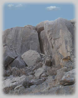
you arrive at the summit area of Jebel Qihwi, you are confronted
with vertical rocks making it appear impossible for anyone to
reach the top without climbing gear, and the skill to use it.
However, you can in fact get to the top without gear, equipped
only with a bit of courage to do some rock scrambling. The key
to the summit is up the vertical crack seen at the right end of
the summit rocks. The route is challenging and requires care but
isn't exposed. When
you arrive at the summit area of Jebel Qihwi, you are confronted
with vertical rocks making it appear impossible for anyone to
reach the top without climbing gear, and the skill to use it.
However, you can in fact get to the top without gear, equipped
only with a bit of courage to do some rock scrambling. The key
to the summit is up the vertical crack seen at the right end of
the summit rocks. The route is challenging and requires care but
isn't exposed.
Enter the crack and you'll see that a little way in, your progress
is blocked by some rocks. This amounts to an overhanging step
of around five feet in height. I got up this by shimmying up with
my back to the right hand wall and using the toes of my boots
on the protrusions on the left hand wall. Eventually I was high
enough to move to my right and onto the top of the step. You can
now continue up the slope above the step where the route widens
out into a cave. Go round to the right and you will see that there's
a hole in the roof, which you can scramble up to, and emerge a
short distance from the summit cairn. Take care up here because
there are some pretty exposed bits.
The view is superb, and on a clear day you can see all the way
over to Dibba, and the network of tracks which link the many deserted
farms in the valley below. Don't forget to take your camera, like
we did!!
Enjoy!!
Roy Richards - November 2002
Waypoint Details (WGS84 - UTM coordinates) |
|
QIHWISMT |
25.743900 |
56.210300 |
Jebel Qihwi |
|
WADIB |
25.781000 |
56.212500 |
Car park |
|
WBCAMP |
25.785100 |
56.215250 |
Camp site |
|
WBCMET |
25.794850 |
56.224030 |
Cemetary |
|
WBJUNC |
25.816770 |
56.205090 |
Khasab rd junc |
|
WBTRACK |
25.794200 |
56.174720 |
Start Jungle Book trail |
|
WBVIEW |
25.802250 |
56.200680 |
Viewpoint |
|
QIHWI-A |
25.771120 |
56.224100 |
Farm |
|
QIHWI-B |
25.765640 |
56.221880 |
Col after farm |
© Roy L Richards 2012
Contact for problems, queries etc:
|


